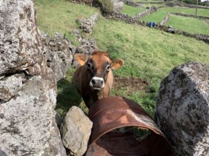
Above the town of Lajes do Pico is a 7.8 mile loop with 1800 feet of elevation gain called Land of Lajes. I had previously downloaded the map on the AllTrails app on my phone. The trail is not well marked an I recommend some sort of trail guide software. Hiking the trail clockwise is recommended as the portion of the loop between 8 o’clock and 11 o’clock is quite steep and rocky. This part of the trail is consistently steep so bring your cardio. The trail winds through pastureland which are walled off with rows of Hydrangeas of towering walls of black volcanic rock. Much of the trail is on farm roads.

During the hike I heard shotguns and saw locals walking the stone walls. I assume they were hunting rabbits. I could not resist stopping and taking many pictures of the rock stone houses, scenic vistas and the many curious cows along the way. Half way through the hike there is a scenic vista which overlooks the southern coast of the island with spectacular views of the two highest points on Pico. I recommend the hike which took me just over 3 hours. My favorite parts were the miles of black stone walls and numerous very cute cows. On my way down the loop between 2 and 4 o’clock there was some minor erosion on a narrow section of trail between two volcanic rock walls. After the hike that the loop was closed. I assume this was due to these erosion issue. Current trail status in the azores can be found on the following website (trails.visitazores.com).
More photos are available to view on my Instagram site (Drrylegoestosea). A some point I will also create a video of the cows on the islands on my YouTube channel (Dr Ryle Goes to Sea). Please consider following/subscribing to both of these.